Elevation Profile North Vietnam: A Cyclist & Hiker’s Guide to Vietnam’s Mountain Majesty
Elevation Profile North Vietnam: A Cyclist & Hiker’s Guide to Vietnam’s Mountain Majesty
Getting Around Vietnam
December 04, 2025
From mist-covered highland passes to lush river valleys, the elevation profile of North Vietnam is as diverse and dramatic as its landscapes. Whether you're planning a multi-day cycling tour, a trekking expedition, or simply want to understand the physical terrain of this rugged region, knowing the elevation changes is key to preparation and performance.
🚵 Elevation Profile North Vietnam: A Cyclist & Hiker’s Guide to Vietnam’s Mountain Majesty
Introduction
From mist-covered highland passes to lush river valleys, the elevation profile of North Vietnam is as diverse and dramatic as its landscapes. Whether you're planning a multi-day cycling tour, a trekking expedition, or simply want to understand the physical terrain of this rugged region, knowing the elevation changes is key to preparation and performance.
Northern Vietnam is home to the country’s highest peaks, steepest climbs, and most awe-inspiring routes — making it a dream for cyclists, hikers, trail runners, and mountain lovers. In this guide, we break down key elevation zones, iconic mountain passes, and how Golden Trail Travel can help you explore it all with confidence.
Elevation Profile North Vietnam: A Cyclist & Hiker’s Guide to Vietnam’s Mountain Majesty
Why Elevation Matters When Exploring Northern Vietnam
1. Physical Demands Vary by Terrain
The difference between a rolling rice valley and a 2,000-meter mountain pass can make or break your journey. Understanding elevation allows you to plan your pacing, hydration, nutrition, and rest points effectively — especially when cycling or hiking over multiple days.
2. Weather and Climate Shift With Altitude
Higher elevations like Sapa, Y Ty, and Dong Van are cooler year-round and prone to sudden changes in weather. Packing correctly and choosing the right season depends heavily on elevation.
3. Cultural Changes Across Elevation Zones
Lowland river deltas are home to different ethnic groups, cuisines, and lifestyles compared to the highland regions, where hill-tribe communities like the H’mong, Dao, and Lo Lo thrive in elevated, remote villages.
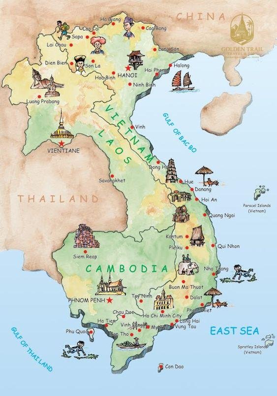
Northern Vietnam’s Elevation Zones and Key Mountain Regions
Red River Delta (0 – 200 meters)
The flatlands surrounding Hanoi, Ninh Binh, and the Red River Delta sit at low elevation. This zone is perfect for beginners and leisure cyclists, offering cultural richness without steep climbs.
Typical Terrain: Flat to gently rolling Climate: Warm and humid Activities: Easy cycling, cultural day trips, river cruises
Northwest Highlands (200 – 1,500 meters)
As you move into Mai Chau, Nghia Lo, and Mu Cang Chai, the terrain begins to rise. These regions include beautiful rice terraces, mild climbs, and mid-altitude mountain towns.
Typical Terrain: Rolling hills, rice terraces, mountain valleys Climate: Cooler than Hanoi; pleasant most of the year Popular Routes: Nghia Lo – Tu Le – Mu Cang Chai cycling trail
Tonkin Alps (1,500 – 2,000+ meters)
Home to Vietnam’s most extreme elevations, the Tonkin Alps include areas like Sapa, Fansipan, Ha Giang, Meo Vac, and Dong Van. This is where the serious climbing begins.
Notable Passes:
O Quy Ho Pass – 2,035m (Vietnam’s highest road pass)
Ma Pi Leng Pass – ~1,500m (Iconic and steep with panoramic views)
Khau Pha Pass – 1,200m (Famous for paragliding and cycling)
Climate: Alpine; cold winters, cool summers, fog common Activities: High-altitude cycling, trekking, cultural tours
Border Highlands (Up to 2,600+ meters)
Fansipan, also known as the “Roof of Indochina,” stands at 3,143 meters and is the tallest peak in Vietnam. Treks to Fansipan or trails in Y Ty and Ban Khoang offer high-altitude adventure in isolated, cloud-covered villages.
Activities: Multi-day treks, summit climbs, technical cycling routes Best For: Advanced adventurers with altitude preparation
Sample Elevation Profiles for Adventure Routes
Route 1: Hanoi – Mai Chau – Moc Chau – Son La
Total Distance: ~250 km Elevation Range: 50m to 1,200m Profile: Gradual elevation gain with moderate climbs and wide roads
Route 2: Mu Cang Chai – Than Uyen – Sapa – O Quy Ho
Total Distance: ~200 km Elevation Gain: Up to 2,035m at O Quy Ho Profile: Intermediate to advanced with steep ascents, switchbacks
Route 3: Ha Giang – Dong Van – Ma Pi Leng – Meo Vac
Total Distance: ~150 km Elevation Range: 400m to 1,500m Profile: Legendary mountain loop; technical descents, jaw-dropping elevation gains
Pro tip: Golden Trail Travel provides route maps with detailed elevation data, GPX files, and real-time support for their cycling and trekking tours.
Why Book with Golden Trail Travel?
Exploring North Vietnam’s rugged terrain requires more than a map — it demands local knowledge, planning, and reliable support. That’s where Golden Trail Travel comes in.
Why Choose Golden Trail Travel for Elevation-Heavy Adventures:
Professional cycling & hiking guides who know the terrain intimately
Support vehicles for multi-day cycling expeditions
Customized itineraries with altitude training advice
Mountain-ready gear, bikes, and logistics
Deep cultural immersion with homestays at various elevations
Traveler Tips for High-Elevation Travel in Vietnam
Train before you arrive: Hill rides or hikes prepare your body for altitude
Hydrate constantly: The air is drier and thinner in highlands
Pack smart: Light, breathable gear for climbs; warm layers for nights
Start early: Mountain weather changes fast — mornings are best for activity
Acclimate: If you're not used to elevation, plan a rest day in Sapa or Dong Van
Common Mistakes to Avoid
Not accounting for altitude – It’s not Everest, but elevation affects energy levels
Skipping recovery days – Your legs and lungs will thank you
Assuming phone signal everywhere – Some high passes have no reception
Neglecting nutrition – Bring energy snacks for climbs and long rides
Real Adventure Reviews
"As a cyclist from Switzerland, I was amazed by how dramatic the Tonkin Alps are. The climbs are real, the views are wild, and the people are so welcoming. Golden Trail Travel handled everything — I just pedaled."
— Marco R., Switzerland
"We trekked from Y Ty to Lao Cai with support from Golden Trail Travel. The elevation changes were intense but rewarding. We felt like we were walking through clouds."
— Emma T., Australia
"I was concerned about the altitude at first, but the itinerary was so well-paced that I adapted naturally. The mountain villages at 1,500m+ are breathtaking in every sense."
— David L., USA
FAQ: Elevation Profile North Vietnam
Q1: What is the highest road in North Vietnam? O Quy Ho Pass, at 2,035 meters, is the highest motorable road in Vietnam.
Q2: Is altitude sickness a concern in North Vietnam?
It’s rare, but sensitive individuals might feel lightheaded at elevations above 2,000 meters. Golden Trail Travel plans itineraries to acclimate gradually.
Q3: Can beginners handle the Tonkin Alps terrain?
Yes, with a support vehicle and properly paced tours. Golden Trail Travel adjusts routes based on fitness levels.
Q4: What is the best time to explore high elevations?
October to April. These months offer cooler temperatures, clearer skies, and better visibility in the mountains.
Q5: Are elevation maps or GPS provided on tours?
Absolutely. Golden Trail Travel offers detailed elevation profiles, GPX files, and live support on guided tours.
Conclusion: Elevation Defines the Journey
In North Vietnam, elevation isn’t just geography — it’s the journey. From gentle deltas to towering peaks, every meter climbed opens up new perspectives, deeper cultural insight, and unforgettable natural beauty.
Whether you're chasing climbs, stunning descents, or cultural encounters perched on mountaintops, understanding the elevation profile of North Vietnam is your first step toward an unforgettable adventure.
Let Golden Trail Travel guide your journey through Vietnam’s most majestic heights. Explore elevation, discover wonder — start your trip here:https://goldentrailtravel.com
Golden Trail Travel Co., Ltd and Golden Cycling Tours would like to inform you of an important security notice.
Recently, we received warnings from Vietnamese authorities regarding an increase in online fraud targeting customers of travel companies and international businesses. Fraudsters are impersonating legitimate companies by using fake email addresses, forged payment instructions, and fraudulent bank account details to deceive customers into transferring funds.
These fraudulent emails are typically sent from unofficial email addresses and include fake banking information intended to redirect payments. This type of cybercrime, commonly known as phishing, is currently being reported and monitored by many organizations and government agencies.
To ensure the security of all transactions, Golden Trail Travel and Golden Cycling Tours use ONLY ONE official tax code and ONE official bank account as follows:
We will never request payment to any bank account other than the official account listed above.
Any phone number, email address, or payment information not included in our official contact details should be considered suspicious and potentially fraudulent.
Before making any payment, please contact us directly via our official hotline , WhatsApp or email addresses if you have any doubts or concerns.
If you receive any suspicious email or any request to change payment details, please notify us immediately so that we can verify the information and assist you.


.jpg "The Epic Cycling Adventure: Rediscovering Your Soul on Two Wheels")
.jpg "The Ultimate Trekking Expedition: A Journey Beyond Boundaries")
.jpg "The Ultimate Guide to Trekking Cao Bang Vietnam: Journey Through the Realm of Mountains and Waterfalls")
.webp "Cuc Phuong National Park Day Trip")
.jpg "Pu Luong Nature Reserve: An Ethereal Journey into Vietnam’s Hidden Eden")